United States Map 1861
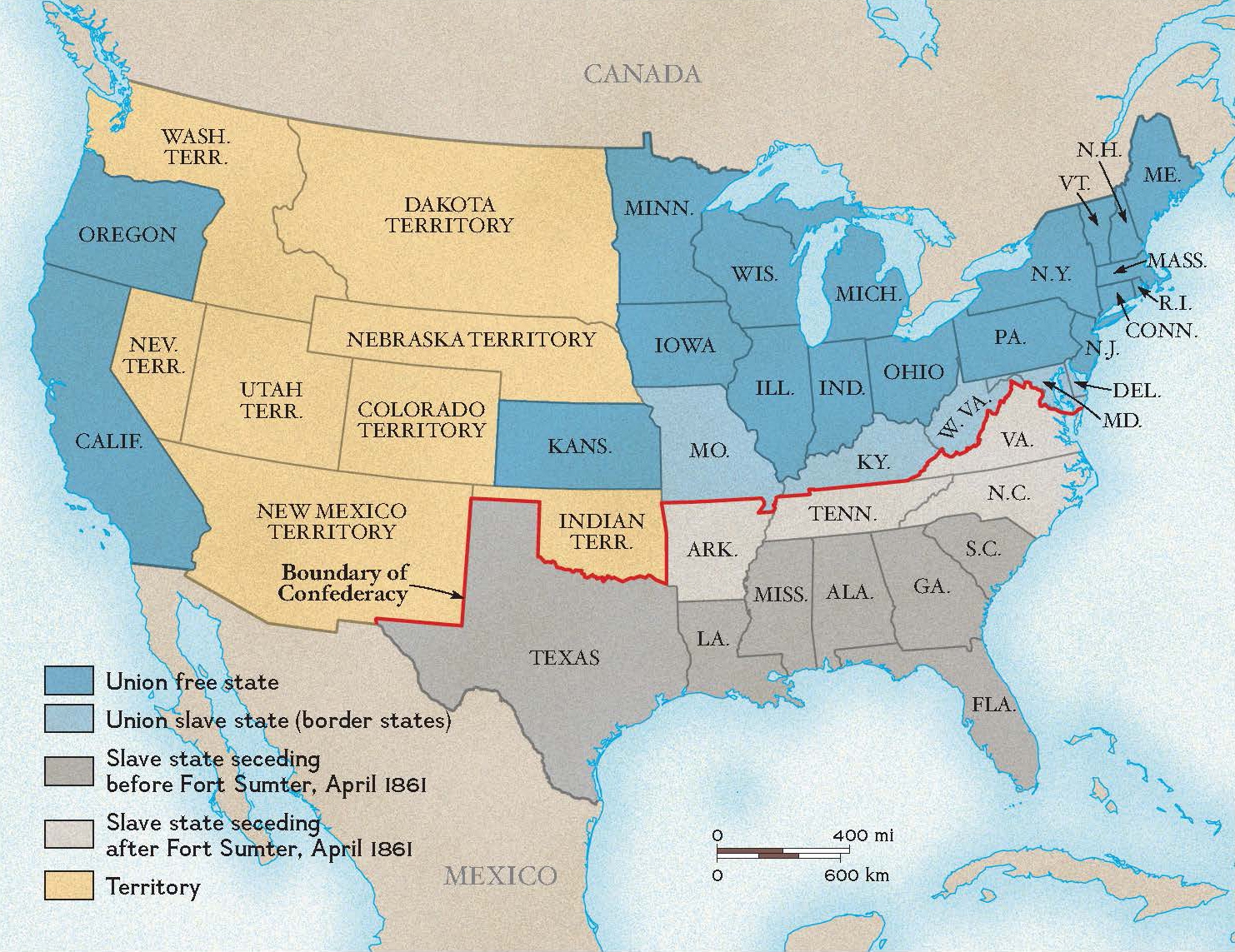
Are you curious about the history of the United States? One way to explore this fascinating past is by looking at a United States map from 1861. Maps provide a unique glimpse into how the country was shaped and divided during that time. By examining a United States map from 1861, you can see the … Read more